2025 was second warmest year on record for Ireland - Met Éireann


2025 was the second warmest year on record for Ireland since 1900, according to the latest data from Met Éireann.
The Annual Climate Statement for 2025 report also shows that the last four years (2022-2025) are all ranked in the top five warmest years on record for the country.
The average annual air temperature for Ireland in 2025 stood at 11.14°C, which is 1.59° above the 1961-1990 long-term average (LTA).
2025 was only slightly behind the warmest year on record in 2023 (11.21°) and only the second time with a mean temperature over 11°.
The report noted that the coldest year on record was in 1919 with 8.73°.
Temperatures
Mean air temperatures across the country were above their annual LTA with all 25 weather stations operated by Met Éireann in the top three warmest years on record.
Mean temperatures for the year ranged from 9.9° (1.1° above its LTA) at Knock Airport, Co. Mayo to 11.9° (0.8° above its LTA) at Sherkin Island, Co. Cork.
The lowest temperatures of the year were recorded on January 9.
Athenry, Co. Galway had the lowest daily air minimum temperature of -7.6°, while the lowest grass minimum was -11.8° reported at Mullingar, Co. Westmeath.
The highest temperature of the year including all official Met Éireann stations was 32.2°, which was reported at Connemara National Park on July 13.
The number of days with ground frost ranged from 32 days at Sherkin Island, Co. Cork to 135 days at Phoenix Park, Co. Dublin.
The number of days with air frost ranged from one day at a number of stations to 45 days at Mount Dillon, Co. Roscommon.
Rainfall
Provisionally rainfall data suggests 2025 was the 15th wettest year since 1941, with an average of 1,338.7mm.
Annual rainfall totals ranged from 804.2mm (104% of its LTA) at Dublin Airport, to 1,809.4mm (110% of its LTA) at Valentia Observatory, Co. Kerry.
The highest daily rainfall total was 66.9mm at Johnstown Castle, Co. Wexford on November 14 during Storm Claudia.
The number of rain days (0.2mm or more) ranged from 184 days at Dublin Airport to 258 days at Newport, Co. Mayo.
The number of wet days (1mm or more) ranged from 134 days at both Dublin Airport and Casement Aerodrome, Co. Dublin to 216 days at Newport, Co. Mayo.
The number of very wet days (10mm or more) ranged from 20 days at both Phoenix Park and Dublin Airport, Co. Dublin to 66 days at Valentia Observatory, Co. Kerry.
There were 64 separate climatological dry periods reported in Ireland during 2025 between January 6 and August 24.
Of these, 18 were absolute droughts (a period of 15 or more consecutive days where none have 0.2 mm or more of rainfall) at 16 stations.
Annual sunshine totals ranged from 1,348 hours at Valentia Observatory, Co. Kerry to 1,721.4 hours at Johnstown Castle, Co. Wexford.

Annual mean wind speeds ranged from 10.9 km/h (5.9 knots) at numerous stations to 26.9 km/h (14.5 knots) at Mace Head, Co Galway.
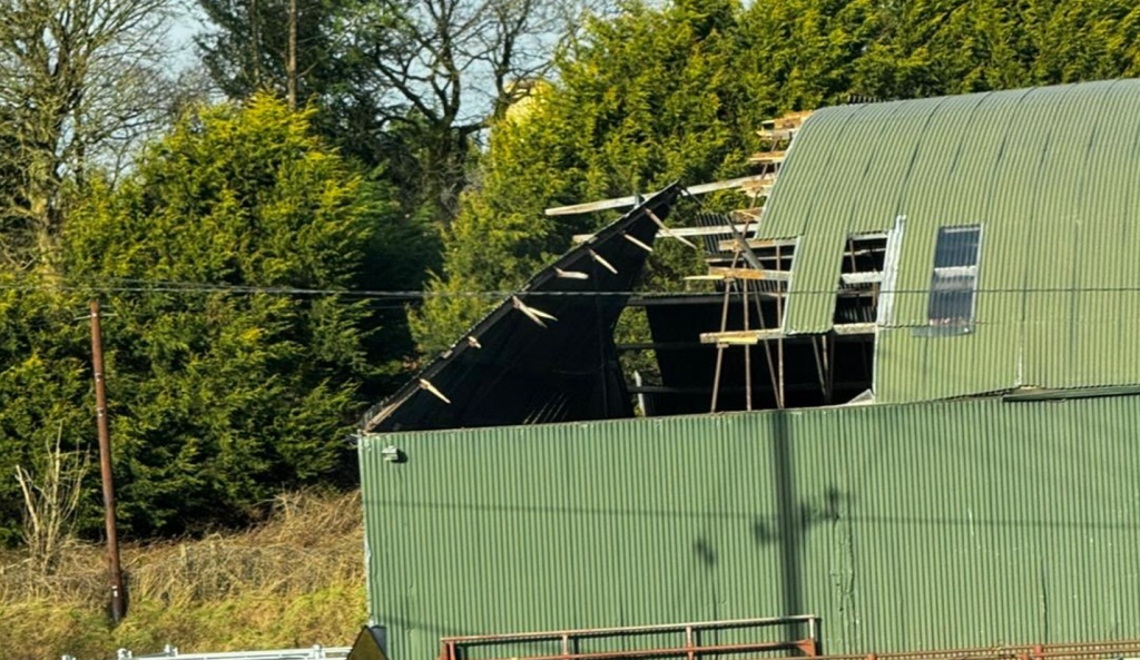
Mean wind speeds reached hurricane force 12 at Malin Head, Co. Donegal and Mace Head, Co. Galway on January 24 during Storm Éowyn.
Both the year’s highest gust and 10-minute mean wind speed were reported at Mace Head, Co. Galway on January 24.
The highest gust was 184km/hr, while the year’s highest 10-minute mean wind speed was 142 km/hr.
These are Ireland’s highest provisional (sustained and gust) wind speeds in the digital climate record.
Met Éireann
Paul Moore, Met Éireann climatologist said: "The warming trend is very clear with the last four years being the warmest four years on record in Ireland, since 1900".
"2025 saw not only our warmest spring, but also our warmest summer on record, with high nighttime temperatures contributing to the summer record.
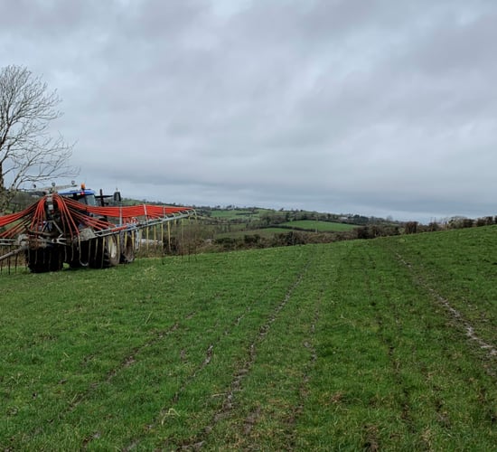
"We experienced five named storms in 2025, as well as a number of impactful rain events.
"The continued warming brings with it the increasing risk of severe weather events," he added.
The report shows the latest Irish climate change projections indicate further warming in the future.
Met Éireann said this temperature change means the likelihood of extreme weather events occurring has increased.
Irish rainfall patterns are expected to change, with an increase in both dry periods and heavy rainfall events. Global sea levels continues to rise.
"Climate change is adding fuel to storms due to warmer waters and more moisture in the atmosphere and studies show that storms we’ve experienced in the past (e.g. Ophelia) will become more powerful, larger, and more destructive in a warmer world," Moore said.